Tuesday, November 14, 2006

Trip Summary

Tried to make up some maps but it did not work out, will try again later and add them to the summary of the trip.

Just for reference 1 nautical mile = 1.15 miles or 1.85 kilometers. A nautical mile is equivalent to the distance spanned by one minute of arc in latitude; 1,852 meters

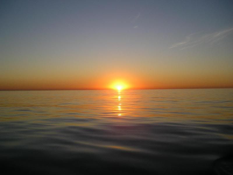
Day 1 Saturday, Oct 28, 2006 Left Berkeley in the morning and headed towards the Golden Gate, Winds were light but took us directly to the Gate without having to tack. Once we were beyond the Gate, we headed south to Pillar Point. Winds remained light so we put up the spinnaker, only to have it jump around and pop the halyard shackle, causing the spinnaker to crash down to the deck and water, leaving the halyard at the top of the mast. We arrived quite late and anchored in the Harbour. Nice breakwater, making for a quiet night. 34 Nautical Miles.

Day 2 Sunday, Oct 29th. Got up early to climb the mast and retrieve the halyard then pulled anchor and continued south. Planned on anchoring at Ano Nuevo and arrived late in the afternoon. Swells made for a pretty rocky anchorage and after assessing, we decided to continue southwards and made for Santa Cruz. Got in fairly late, making our way through the bay and into Santa Cruz harbour. 50 Nautical miles.

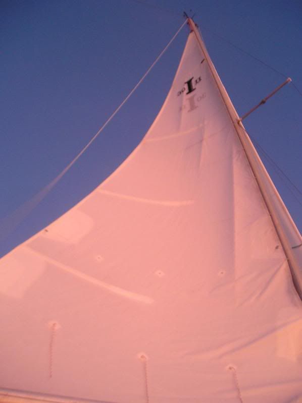
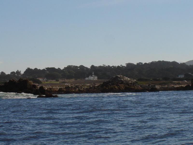
Day 3 Monday, Oct 30th. Very Pleasant day. Left Santa Cruz after fueling up, and headed south across Monterey Bay. Nice winds, sun, put the spinnaker up for a few hours and enjoyed a great sail and a great sunny day. Arrived in Monterey, which had more sea lions than Sea World. They were everywhere and all barking to let us know they were there. The harbormasters office was very friendly and they set us up in a slip near the office. Shopping near by. We decided to stay an extra day. Walked through Cannery Row on the way for groceries. This was a warehouse area at one time, the center of the fishing industry and the basis for John Stienbecks book "Cannery Row" which eventually was made into a movie. That evening there was a market on one of the nearby streets so we went shopping. Happy Halloween, some scary creatures out there.... 23 Nautical miles.

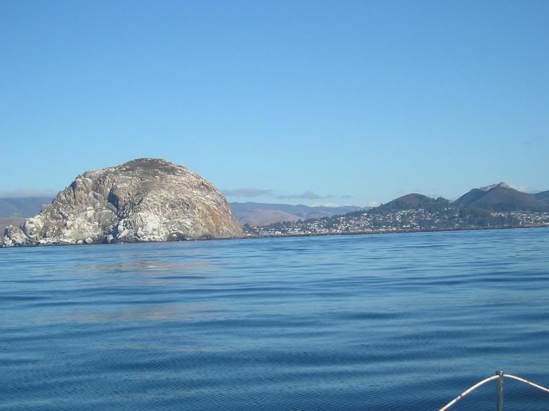
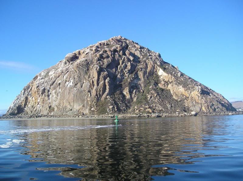
Day 5 Wednesday, Nov 1. Big two days, decided to make the push for Morro Bay, leaving Monterey and following the coast along Big Sur. Nathene and I had looked at doing the Big Sur Marathon last year so it was neat to look at the route and seen some of the topography. During the night, Bonnie spent much of her time at the wheel in the company of dolphins playing around the boat. I got up and took over and they left me sitting at the wheel in the dark with showers until dawn. We bypassed Simeon Bay, site of the Hurst Castle and made it to Morro Bay late in the afternoon, tying up on the Morro Bay Yacht club dock. Great hospitality! Supper out, and a tour of the local stores in the morning. Another boat had just arrived with a solo japanese sailor who came out of Japan to BC in 41 days and was making his way down the coast. 107 Nautical miles.

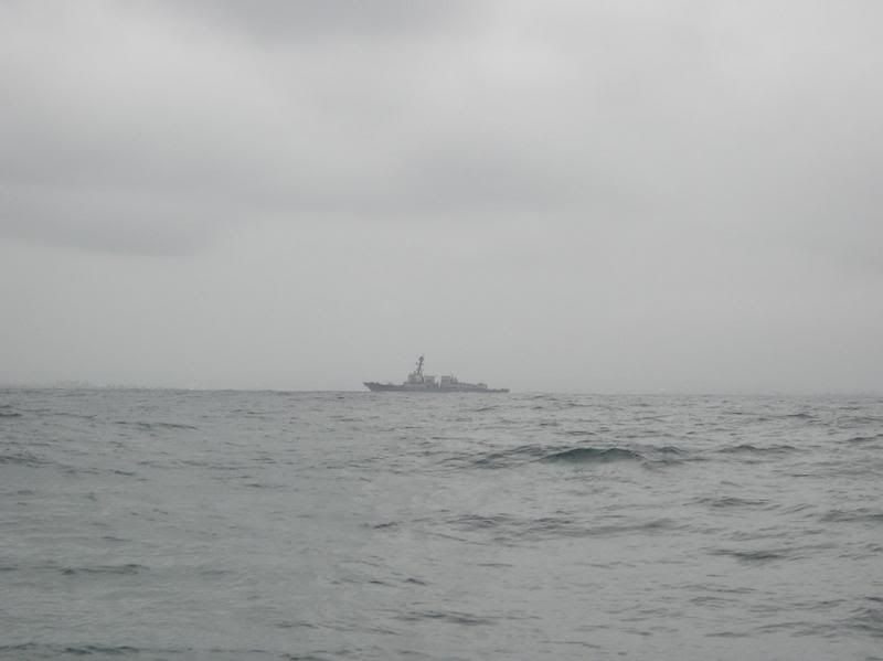
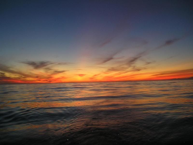
Day 7 Friday Nov 3. Fueled up and hung around waiting for the fog to lift. It finally did and we set out in sun only to catch up to the fog later. It rose up to an overcast day, clearing near sunset to start a bad night around Point Conception. Gale force winds, heavy seas, black night, drilling platforms, missle tests, and the US Navy all part of this night. Winds were so strong that they blew the flag for the overboard pole off and it was lost at sea. Anchored in swells at coho anchorage by 0130 hrs. 73 Nautical Miles.

Day 8 Saturday Nov 4. Pulled anchor in sunshine and light winds, setting sail for Santa Barbara. We arrived late again, after dark, and found our way through shallow waters, kelp beds, and into the bay. The harbor patrol did not have any berths left but allowed us to tie up to thier dock for the night. Nice to have power, a beer, and a few nachos. A litttle shopping in the morning but we haqd to leave by 0930 hrs. Chatted with a crew member from "Laura" a little motor yacht that had just come from France via the Panama Canal. Had to go short handed with only a crew of 28, poor guys. 41 Nautical Miles.

Day 9 Sunday Nov 5. Sunny day to Channel Islands. Nice harbour, friendly. Went for supper, showers, landery, and stocked up on some ice. 30 Nautical Miles.

Day 10 Monday Nov 6. A little shopping on the way out of the harbour, and south towards LA, sailing across Santa Monica Bay. Winds picked up for a while making for choppy seas, then the winds lightened up. Phoned various marinas only to be told no slips available, after checking to see what type of boat we had. Not prestegious enough for some, one actually hung up on me. LA was not friendly to us. Ended up in a marina in San Pedro bay. San Pedro bay is a big shipping port with large unloading facilities and lots of activities. 65 Nautical miles.

Day 11 Tuesday Nov 7. Departed early for Oceanside. A pleasant day, a little cooler but nice. Watching out for the big ships and fishermen coming out of the bay, busy place. Down the coast, past Newport beach and the ocean glassing over before the end of the day, arriving just at dark. Friendly place once again. 57 Nautical Miles.

Day 12 Wednesday Nov 8. Making the big push to try to get to Ensenada. Stopped by the navy for another missle test. Lots of traffic on the radio from warships in the area. Ended up coming in late aqain and into Mission Bay. Anchored in a free anchorage, good for 72 hours max. but we were only staying 12 hours. About a 1/2 dozen other boats also anchored there. 31 Nautical miles.

Day 13 Thursday Nov 9, fueled up at about 3.80 a gallon for diesel, wanted to empty the holding tank, but the pump out was broken. Grrr. Headed out, lots of helicopter traffic and we were hailed by a warship wanting us to stay at least 500 yards away as he traversed through to San Diego harbor. At 5 knots, we could not have gotten near him. Several helicopters came over and checked us out. Once we got close to the Mexican border, we started seeing much more wildlife again. Got in to the Coral Hotel and marina early in the morning and were met by Luis from Security. He set us up with a berth and made sure we were comfortable for the night. 65 nautical miles and the end of this trip.

Total distance 576 nautical miles or 662 miles or 1067 Kilometers

Day 14 Friday Nov 10. Spent the day resting and doing paperwork to secure the boat in Mexico.

Day 15 Saturday Nov 11. Cleaning up then back to San Diego to catch the plane home, arriving around 11 pm.

Friday, November 10, 2006

10 years in Mexico

We got in late last night, or early this morning actually. Fairly good trip from San Diego, started slow with no wind, then it picked up and moved us along. Our inital estimated time of arrival on the GPS was putting us as late as 8:30 this morning, but with the winds, we got in shortly after midnight and secure to a berth by about 1:30 and to bed. What was interesting was that we both noticed a distinct drop off in wildlife sightings when we hit about Santa Monica Bay, then LA, and finally as we got close to the Mexican border, we started seeing more birds, seals and dolphins again. Lots of dolphins chasing around the boat late in the afternoon and through the evening which was great. Very little light until late when the moon rose and brightened things up a bit. Came across a fishing trawler that turned his lights on when we were not far apart. Surprised me a little too much and I veered to avoid him.

I had expected to see more vacant coastline but there were lots of lights on shore, lots of development. There are an estimated 1.5 million american owned homes along the mexican border. Some are primary and commute, some are vacation homes. You can imagine what the Mexican Government feels about the big fence that the US wants to build along the border....

This morning and this afternoon was spent dedicated to paper and I finally got all the paperwork done. Talk about doing the cha-cha! I actually paid the marina to help me with the process. Got mexican insurance, Bluewater insurance neve did get back to me with the quote that they were to provide once I gave them the surveyors report.

Took 5 copies of everything plus the marina staff person, went to the port captains office and to customs and immigration. Get some forms stamped, go to the bank window, pay, come back get more stamps, go to the next window, fill out new forms, go the bank, pay, come back, get stamped, etc. for about 2 hours with the marina guy coaching me and explaining things to the customs and others in spanish. The last thing I had to do was push a button on this big light post. It looked just like a cross walk light with the green and red lights. The light came up green and I was told to "go". If it had come up red, then they had to come and inspect the boat.
At any rate, the boat can now stay in mexico for up to 10 years. We have all of the ownership papers, the registration papers, the immigration papers, and even a few rolls of the cheapest toilet paper Mom could have ever bought when she was in Berkeley with me last fall. But we are good to go!

The boat is secure at the marina here until mid december, (or later if we wanted) when we move it further south. Should be a continuing adventure.

Any one interested in crewing on leg 2?

Ensenada, Mexico

we made it! i just spent the morning laying by the pool, being attended to by cabana boys. actually, there were no cabana boys-- not even the Offer a drink! you can tell it's the off season.

yesterday started out kind of slow; literally, the winds were against us again and the water was pretty choppy. after awhile though, we were able to turn past point loma and we got a bit of a westerly wind, and actually got some of best, non-storm speeds in! regardless, since we stopped in the north san diego harbour instead of the south one, and still had bad wind for the first part of the day, we only made it in to ensenada last night around... midnight.

that's good though; if we'd stayed at our morning speed, we weren't going to get in until 2pm this afternoon. not so neat.

we're at the "Hotel Coral & Marina", and it's pretty nice. there were 2 guys up at the dock when we came in at midnight who set us up, and we got a 30 foot slip right away, which will be available to keepuntil mom and dad come back in december. it's also pretty ritzy though; apparently there is a law in california that if your boat is out of the country for 90 days of the year, you don't have to pay taxes on it... so there are a LOT of very expensive boats out here. i'm talking of hundreds of massive yachts. sections A-E are all full of them, multiple decks, 100' at least, all gleaming chrome and black paint. dad was pretty nervous last night trying to navigate through them all while trying to find somewhere to dock and get a berth. it's just ridiculous.

so, this is it! tomorrow we get a shuttle to the san diego airport and fly back to sweet calgary with it's -15 + windchill. this trip has been nothing like i've ever experienced, and was a pretty cool little adventure.

enjoy the pictures, and i'll see if dad has anything to say!


destruction! destruction! sorry, a little choir joke there. these things were EVERYWHERE once we passed point conception... massive brutes, too.


yet another incredibly gorgeous sunset


setting sail out of san diego... what a gorgeous morning


dad at the helm


some dolphins that accompanied us across the US/Mexico border


this was the navy ship that kept on eye on us during the missile launch!


a lot of heavies out here; and most of them gave us a fly by. us. the little 30' sailboat. here's one of the sikorskys...


and here's a seahawk.


we were hailed by this one; a US navy warship, telling us not to get too close. that's really all he had to say, not even a thank you. we're definitely not in canada anymore... :-)


berthed at the hotel coral marina


sunset on the sail

Thursday, November 09, 2006

San Diego

this'll have to be QUICK, dad's already pulling anchor to get out of here...

a fun couple of days. LA was mean. we went extra long that dayto get through LA, because no one had ANY slips available... once they found out that we were just a little sailboat. the next day we set out, and were stopped by a navy vessel... because we happened to be passing ANOTHER navy base that was doing a live missile launch! what are the odds! this time we were stopped for an hour and watched the fighter jets fly around and heard the missile launch, it was pretty cool. made it to oceanside 2 nights ago and passed out.

yesterday went from oceanside to san diego. the winds were not in our favour. actually, they went against us the WHOLE time, so did the waves. we wound up being at sea for quite some time, and it was rather unpleasant. very slow going. more naval activity yesterday, this time hearing submarines call ships telling them "don't go forward, i'm off your port bow" and seeing TONS of heavy helicopters flying around. 6 or 7 at once near oceanside.

today, to ensenada? wish us good wind, and another wireless port to track down!

Sunday, November 05, 2006

My first update

This blog is supposed to be by the two of us and Bonnie has been doing all the work.

What a trip so far.. and such a big difference in the weather north and south of Point Conception. I can hardly believe it, but am very thankful for it.

Bonnie wrote a few words about our crossing through Point Conception, also described as the Cape Horn of California. It was by far the worst wind and waves that I have ever experienced, or imagined.

The day started with fog in Morro Bay, then a little sun, so we headed out. Light winds forecast, no worries, should be a smooth crossing. Fog rolled back in, and we used the GPS for all the navigating, taking a wider berth to avoid the shoals and rocks close to shore. The wind finally picked up a bit, the fog lifted and we had good sailing under cloudy skies up to near dark. About then, we got an advisory from the Coast Guard indicating that winds were going to pick up to 15 knots, gusts to 25. At this time, we had gone past the turn point but it did not sound to bad. None of the wind forecasts had reached the forecasted winds yet.

The winds did start to pick up and got quite brisk. We were making great time, with some of the fastest sailing we had this trip. About dark, the winds really started to step up and we rolled in the jib with the furler so that we had about 3/4's out. Still making 6+ knots, when bang, the wind really started to blow hard. Just then, we got another weather update indicating winds to 25 knots, gusting to 35.

Bonnie has proven herself as a great helmsman, stays on tack, good sailor, but the winds were starting to get pretty heavy. I reefed the jib so that we were about 50% and then strapped on the safety tether to my harness and moved onto the deck to reef the main sail. It was rock and roll but Bonnie kept the boat as steady as she could while I put in the reef. This helped a lot but Bonnie had enought and turned the helm over to me.

We continued to move ahead with the seas around us increasing in size and the wind holding steady. The boat held course, by now it's dark and we were trying to take a wide berth around the point to keep away from the rocks, thanks to the GPS. Suddenly the winds really started to blow and I was struggling to hold the helm. Bonnie took the wheel and I furled in all of the jib, then climbed back on to the deck to put a second reef in the main sail. It was like riding a wild bull while getting beat with base ball bats and sprayed with sleet. The boat slammed back and forth with the boom smashing me in the chest at least 5 times, knocking me over at least once, but I was tethered to the boom. After what seemed like forever, I got the second reef in and the boat became more manageable. But the wind continued to scream and howl while the seas continued to rise.

The wind was behind us and the seas were moving with us. The rollers were about 20' high and would come in behind us, pick us up, and push us forward, speeds up to almost 9 knots as we slid back down the wave and into the trough. Each wave, I fought the wheel to keep the boat from broaching and would turn it back ahead at the bottom of the trough. Well ahead of us was a light that was right on our path. As we got closer, we could see it was a drilling platform. I steered us as close to it as I could and came within a 100' of it. We could see the windsock standing straight out, but there was no place for us to pull in. Waves were crashing over the lower level platform. I ducked behind the platform and used it as a break from the wind and waves. It is as large as a small island and gave us a few minutes to catch our breath then carry on. In the wind and waves, I could hear a pod of dolphins following us but I did not have time to look for them or enjoy thier presence.

As we neared the point, I was trying to get us behind the land form to shelter us from the big rolling waves but with the reefed main and no jib, the boat would not turn. We could not have controlled it as well anyways going across the waves. Eventually we got far enough in that the waves started to ease and we continued to be pushed ahead with the wind the double reefed main.

By about 10 or so, we were past the point and headed for shelter at an anchorage called Cojo. Bonnie and I both looked back and saw some sort of light that we thought was a marker buoy that was not on the chart. A few minutes later, it disappeared. Around 11:30, I thought I saw some red flares being fired off near land, so I called the coast guard on the emergency channel. I got an immedate response from a vessel asking us to identify ourselves and were we the vessel off of his port bow. We looke back and saw these light from a patrol vessel. Turned out it was not the coast guard but a navy ship sweeping the area to insure there was no stray traffic in the area because of thier missle tests. We were in a area that was to be closed in a half hour to all except the military. They were having trouble hearing me on the radio because of the wind. After verifying our destination, we were given permission to continue on to Cojo, although I am not sure where else we could have gone. They had not seen the flares but were going to watch for them. A few minutes later, all of thier lights were out, but we know they were watching us pretty close.

As we headed west, the skies cleared, the seas eased, and we whipped along with the reefed main, Bonnie laid down for the last hour, and I woke her as we came into Cojo so she could help me set the anchor. Lots of swells in the anchorage, and the wind continued to howl until just before dawn. I slept little, getting up to make sure the anchor was holding.

Come morning, we pulled the anchor and headed down the coast to Santa Barbara with light winds, gentle seas, sun, and warm enough to wear shorts and t shirts.

Bonnie did a great job in some of the worst conditions I could imagine, and without her help, it might have been a different story. We did discover that there are limits to the effects of dramaline that she takes for motion sickness. The wave height exceeded the forecasted by a long shot and the winds were steady at 35 or greater rather than 25 with gusts to 45 or so.

The safety equipment that I had bought was well worth it, I plan on picking up a few more items, and replacing a few. The new flag that I bought just 1 day before for the overboard pole was torn off or blown off by the wind. I had replaced the radio with a new unit that also shows your gps location when you transmit, which was a great thing. This is how the navy knew it was me off of thier bow. I also got a wireless mic which I can carry with me right at the helm, rather than going inside to talk on the radio, can't imagine what it would be like without it. The GPS we bought also ties into the transducer on the bottom of the boat so it gives us sonar as well as depth and sea temperatures. This has been a big help as well. As a side note, I was amazed at how many fish there were out beyond the point as I was rounding it for the anchorage, not that anyone could be stupid enough to try to fish for them.

In contrast to our night of hell, the last two days have been exactly what I pictured crusing to be about. Sunny, warm, light winds, easy sailing, and all care free. Hard to believe it is all part of the same trip.

Channel Island Harbour, Oxnard, CA

we're definitely in southern california now. the water temperature has risen 8 degrees since we left berkeley! the sun has been shining, the wind light and brisk, and i'm a lovely shade of orange, which i believe is a combination of sun and wind. neat.

the trip on friday from morro bay was hell. i don't think that i've been been so terrified in my life. we were in the middle of the ocean; no one really knew where we were, where we were going, when we left... we were in the middle of a massive fog bank, and couldn't see land. the weather when we left was... fine. gentle winds at 5-10 knots, kind of choppy water but small swells; what we wound up with? a small craft warning, 45knot winds, and 24 foot swells.

by nightfall, i gave up my duties at the helm. i couldn't control it. the winds were at 30-35 knots, gusting to 45. the waves were white capping, and the boat was "falling" off them from the top-- i don't want to say surfing because that's not what it was. it was scarier than that. at one point, i was holding on the side of the boat and reaching with my feet to push back against something, anything... and there was nothing. we furled the jib and reefed the mainsail to try to antagonize the wind less, which meant that i had to take the wheel again while dad tethered himself to the boom and wrestled with the sail. he was tossed around pretty hard, and i just stood there, fought the wheel, and screamed. that's pretty much all that i could think of to do. i've never felt so ineffectual or powerless in my life.

we were battling our way around point conception, which is notorious for being hard to navigate in good weather, and we were being tossed around like a toy. to make things even cooler, we missed a notice that the coast guard and navy were getting together to do a live missile test in our exact area. at least they knew we were there though; trust me, they were watching our every move from the moment that we contacted them until when we made it around conception.

another big problem we encountered was the fact that we couldn't turn out from our heading enough to make it into a protected harbour. everytime we tried to angle the boat, we were sideswiped by those waves. finally we came up on an offshore oil rig, and got into its lee side... once we had a -bit- of protection, we angled in quickly, and made it to land. we found rough anchorage at a little place called Mojo at 3am, then woke up at 7 when the swells started getting rough again.

Saturday was... completely different. gorgeous. calm. sunny. we made it to Santa Barbara last night, and then sailed in to Oxnard today.

i can't really talk about these last 2 days after friday. there's nothing to say. it was simple, calm, and gentle. we bought some more groceries and have been working on building our appetites up again. so long as there is no repeat of friday, we're looking in really good shape to make it to ensenada by this coming friday friday, ensenada being our new goal for a final destination.

early to bed tonight, i think... we didn't take any on friday since we were a bit preoccupied, but here are a few of the sunset we saw last night.


Thursday, November 02, 2006

Morro Bay

We made it! It only took 28 hours, not 30! Amazing!

It was actually a decent sail. We took the mainsail and the jib out a few times, but they only really benefitted us once, during dad's 2200-0100 shift. We originally planned on doing 2 hour shifts, but there wound up being a half hour overlap for the other person to wake up and make coffee etc etc, so we extended them to 3 hours.

We had a farewell committee of some of our friends, the sea lions...


The first few hours from Monterey out before sunset were really nice. We saw all sorts of ritzy places along the coast, like Carmel by the Sea and Pebble Beach. We may or may not have seen Tiger Woods. Probably not. Ok, I made that up, we just saw people walking on the golf course and assumed that they were big stars.


Dad at Pebble Beach


The Carmelite Convent


Once the sun set, it stayed light enough to see for quite some time. The moon was out, but it was slowly being blocked by clouds. It only really got to be pitch black and kind of rainy by about 2am. Thankfully Dad thought to stop into some stores in Monterey and get us some rain suits... they really did the trick.

So my shift began at 1, Dad got to bed by 1:30, and around 2:15 a whitish grey dolphin decided to dive out of the water about 2 feet away from me. That definitely woke me up. A few minutes later I saw something strange in the water-- it was pitch black Everywhere, but heading directly for me from the West was a double shot of white light underwater. I panicked a little as I had never seen anything like this, and my first thought was "oh my god, its a bomb". Turns out that there's an algae in the water (phosphorescent?) that turns a florescent colour when its disturbed... and what I saw were 2 dolphins swimming towards me and under the boat. Damn, they're FAST! They circled the boat a lot, jumping out of the water Really close to me, then swimming back under the boat, swimming away, playing in the wake... and suddenly they were gone. 20 minutes later, the 2 appeared again... and this time with friends. There were at least 6, but I couldn't really keep tracked, they were moving so fast and in every direction.

They stayed with us until about 4. I woke Dad up a few minutes early when they were all out again so that he could see them-- good thing, because that turned out to be the last time we saw them.

Dad took the 4-7 shift, and was miserable. It started pissing rain, was pitch black (with no dolphins), and he couldn't make out shore anymore. By the time I took over again, we were passing the Piedros Blancas lighthouse...


Yeah... it was pretty dismal out there.

Things cleared up later in the day, Dad woke up and started puttering around, so I napped a fair bit longer than my share. We made it in to Morro Bay by 1530, docked at the Yacht club, and here we are.

Plans for tomorrow; fuel up, and set sail. Don't really know what the plan is. It's going to be another big sail, this next leg takes us around Point Conception, which is apparently pretty rough. We'll be heading for... Santa Barbara? We don't really know yet. Heh.

Enjoy the last few pictures!


Dad driving into Morro Bay...


Bonnie driving with Awesome hair


Morro Rock; it used to be a big abalone reserve, but it became "contaminated"; fascinating how it stands out so massively compared to the nearby mountains, no?


Morro Rock

Docked for the night.